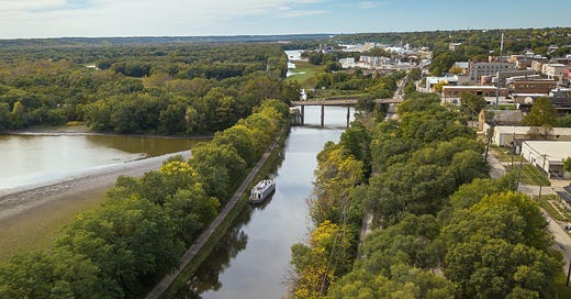
Hello, everyone, and welcome to another edition of Canal Stories, a series brought to you by the Canal Corridor Association to celebrate the 175th anniversary of the Illinois & Michigan Canal and the communities that were shaped by its legacy. Today, we’re taking a detailed look at the generations of waterways that helped develop the I&M Canal National Heritage Area over time; a history written by our friend, Ronald Scott Vasile.
People today tend to forget just how important waterways were to the development of the United States in the 19th century. Before railroads and paved roads, water was the cheapest and easiest way to move people and goods across the country’s broad expanses, starting with the Native Americans, who used prairie rivers for both trade and travel.
The completion of the I&M Canal in 1848 ushered in a new era of mobility and commerce. The I&M was then succeeded in 1900 by the much larger Chicago Sanitary and Ship Canal, which remains part of the modern day Illinois Waterway system.
Water transport of goods is still a major part of our economy, and barges filled with bulk cargo are a common sight on the Illinois Waterway.
Two Great Waterways
While originally situated on wet prairie and marshes, what is now Chicago had long been an important location for Native Americans. The two great watersheds of the United States almost met here, the waters of the Great Lakes and those of the mighty Mississippi River.
Countless generations of Native Americans paddled canoes a few miles down the Chicago River to Mud Lake, a vast marshland. During most seasons, only a short portage was necessary to carry canoes and trade goods between Mud Lake and the Des Plaines River, allowing boats to pass from the Great Lakes all the way to New Orleans and the Gulf of Mexico.
While derided by some as a sluggish little stream, the Chicago River has shaped Chicago’s rise to the ranks of a world-class city. Like the other lakes and rivers in the area, it was formed about 12,000 years ago, as the glaciers that once covered the region retreated northward.
When construction of the I&M Canal began in 1836, the Chicago River still ran through wet prairies, but as people began to pour into the city, the land was drained and filled in. The banks of the river were soon dotted with lumberyards, docks, and meatpacking plants. The South Branch of the river supplied water to the I&M Canal, and at Bridgeport, the eastern terminus of the I&M Canal, a small enclave of mostly Irish canal workers sprang up. Boats were towed from the canal to the mouth of the river and Lake Michigan.
The I&M Canal
The I&M Canal represented a bold plan to make a permanent water connection between the Great Lakes and the Mississippi River. When the canal opened in 1848, people in northeastern Illinois experienced a revolution in travel. In April of that year, passenger boats began making the 96-mile trip between Bridgeport and LaSalle. For five years, before railroads paralleled the route of the I&M Canal, thousands of people experienced the joys and travails of traveling via canal packet, or passenger, boats.
Thanks in part to the commerce generated by the I&M Canal, Chicago Harbor was the busiest port in the nation by 1870, far outstripping New York, Charleston, Philadelphia, Mobile, San Francisco, and Baltimore combined. A steady stream of people and goods traveled between Chicago and the East Coast, and vice versa, using the I&M Canal, lake steamers, and the Erie Canal.
Lake schooners filled with lumber from the forests of northern Michigan and Wisconsin were a common sight on Lake Michigan. The wood was transferred to canal boats and shipped on the I&M to build houses in the tree-sparse prairie region.
As the final link in a series of waterways, the I&M Canal gave travelers the option of taking an all-water route that connected Buffalo, Chicago, St. Louis, and New Orleans. These water highways provided a mud-and-dust-free alternative to overland travel.
The I&M Canal survived until 1933, thanks to its capacity for shipping heavy bulk goods. While some predicted a quick demise for the I&M after the railroads paralleled its route in 1853, the little canal more than held its own in shipping freight for decades.
Competition from the canal forced the railroads to keep their freight rates lower, to the benefit of consumers everywhere. In other parts of the country, where railroads held a monopoly, they were able to charge what they wanted, without fear of serious competition. The canal was also hailed as a more democratic form of transport, as anyone with a boat could enter the shipping business.
The main items floated over the canal included lumber, coal, limestone, corn, agricultural equipment, such as plows and reapers, furniture, and clothing. Trade on the canal increased sharply during the Civil War. With part of the Mississippi River in Southern hands, nearly all of the North’s internal trade came via the Great Lakes, thereby increasing the importance of Chicago at the expense of St. Louis.
Between 1860 and 1865, shipments of corn doubled to eight and a half million bushels, while loads of flour increased six-fold. The amount of salt transported went from 12,000 barrels to almost 80,000. The war-time boom continued after the war ended, and in 1866, the I&M Canal recorded its best year ever, in terms of tolls, with over $302,000 collected.
Industry Moves South to the Calumet Region
The Calumet region is a largely engineered landscape. In 1849, the Calumet Feeder canal opened, supplying water to the I&M Canal, while also boasting a booming freight business. Twenty years, later U. S. Army Engineer Junius Wheeler recommended against improving shipping facilities at Calumet, arguing that the area was too undeveloped to warrant the expense. Nevertheless, in 1870, the federal government appropriated $50,000 to begin work on Calumet Harbor, and by 1876, over 41,000 tons of goods had been shipped through Calumet. A few years later, the first steel mill opened in South Chicago, fueling a boom that ran unabated for years.
Commerce on the Great Lakes also boomed, and the Chicago Harbor’s share peaked in 1889, at over ten million tons. That same year, despite harbor improvements, less than a million tons came through Calumet Harbor. The Calumet River was straightened and dredged in the 1890s, and the channel of the Grand Calumet was also moved and straightened. By 1900, steel mills, oil refineries, chemical plants, and packinghouses had all located along the Calumet waterways, creating jobs and making the Calumet area Chicago’s industrial center.
By 1916, on the eve of U. S. participation in World War I, Calumet Harbor handled over ten million tons to Chicago’s two. It soon became the most important harbor on the Great Lakes. In 1922, the Calumet-Sag Channel was dug, connecting the Little Calumet River with the Sanitary and Ship Canal, allowing wastewater to be diverted to the Illinois River.
Deeper and Wider: The Chicago Sanitary and Ship Canal
By the 1860s, Chicago’s drinking water was a civic embarrassment. While Lake Michigan provided a seemingly endless supply, all of Chicago’s waste was dumped, untreated, directly into the Chicago River and the lake, leading to epidemics of waterborne diseases.
The audacious solution? Dig the I&M Canal deeper, thus allowing lake water to spill down the canal, taking with it all of Chicago’s sewage. While downstream canal towns, such as Lockport and Morris, were not pleased to receive this gift, Chicago’s 1871 reversal of the Chicago River made headlines all over the world. A few months later, some saw it as divine retribution when much of the city burned in the Great Chicago Fire.
Unfortunately, the 1871 reversal proved to be only a temporary solution, and diseases such as cholera, and especially typhoid fever, were still common in Chicago. Plans were then made for a larger canal, and in 1900, the Chicago Sanitary and Ship Canal (also called the Chicago Drainage Canal) opened, permanently reversing the flow of the Chicago River.
Many of the techniques pioneered in this engineering triumph were later used in building the Panama Canal. A need for laborers to dig the Sanitary and Ship Canal also resulted in the first major wave of African-American migration to the Chicago region.
The Illinois Waterway

The Illinois Waterway System covers 357 miles between Lake Michigan and the Mississippi River at Grafton, encompassing eight locks and dams. Like the I&M Canal, the Illinois Waterway initially began as a state public works project. In 1929, when the Great Depression struck, it was two-thirds completed. The U. S. Army Corps of Engineers took over in 1930, and three years later, they had finished the job.
Opened on June 22nd, 1933, the Illinois Waterway is a critical piece of the 1,800-mile Mississippi River System, the water link between America’s midwestern heartland and the ocean-going ships at New Orleans on the Gulf of Mexico. The entire U. S. inland navigation system covers nearly 12,000 miles and carries 630 million tons annually.
The top commodities shipped on inland waterways today are coal, petroleum products, sand, gravel and stone, and food and farm products. A typical barge holds 1,500 tons of cargo, and one towboat can push fifteen barges. Illinois’ share of this transportation highway ranks third in domestic cargoes, with over 100 million tons.
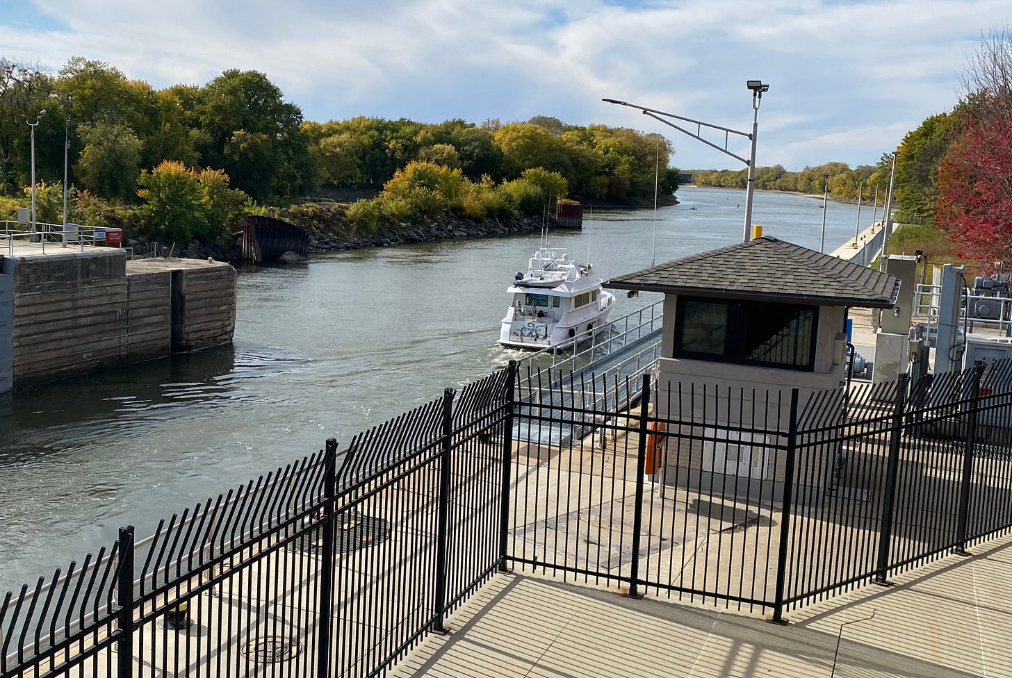
One of the most popular places to view the Illinois Waterway in action is at the Illinois Waterway Visitor Center in Utica. Opposite Starved Rock State Park, the lock and dam provide an opportunity to see huge barges locking through, just as boats did on the I&M Canal. Even with our technological advancements, water is still the cheapest and most efficient means of transporting bulk commodities today.
That concludes today’s Canal Story. Thank you so much for joining us as we continue our journey through the history of the Illinois & Michigan Canal. If you’ve enjoyed this episode, pass it along to your family and friends, and we’ll see you again very soon.


